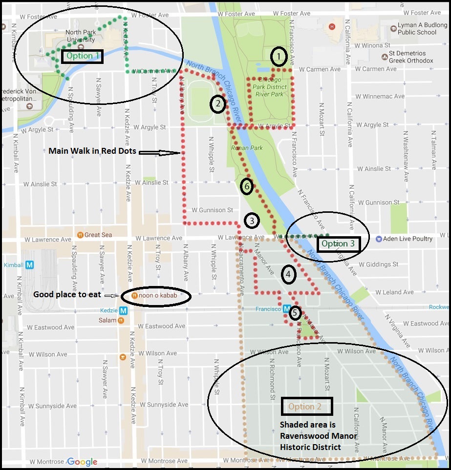
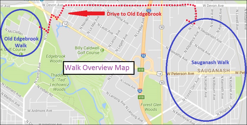
Length of Walk: The walk through Sauganash is 2.0 miles. You will then drive 1.5 miles to Old Edgebrook and walk about a mile there.
Where it is Located: Sauganash and Old Edgebrook are neighborhoods within the Community Area of Forest Glen. It is Walk #14 on the Walks Location Map.
How we got there: We drove and parked where we wanted to start our walk in each neighborhood. Street parking is easy and plentiful. Public transportation options can be reviewed at: CTA Trip Planner
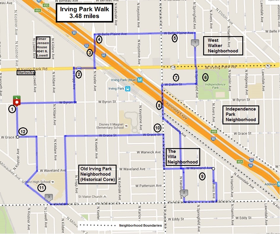
Marge’s Comments: You will forget you are in the city of Chicago when you walk these neighborhoods! Upscale, pretty, historical and nestled in the woods, you will feel far from the grit of the city. The residential architecture in Sauganash seems more diverse than elsewhere in the city. Instead of the usual bungalow and four square, you will see some unique Art Deco and Art Moderne homes as well as various revival homes in the French, Colonial, Italian and Tudor style. If you feel miles away from the city in Sauganash, you might feel like you’ve escaped to the country in Old Edgebrook, which lies within the Cook County Forest Preserve of Edgebrook Woods.
Ed’s Comments: These two walks, so near each other, are a wonderful way to experience the contrast of different Chicago neighborhoods. Sauganash is a charming, suburban-like old neighborhood with interesting, well maintained homes and a historic parish church. Not much has changed in 50 years and, in a sense, time has stood still for the visitor.
Old Edgebrook is a two block village in the middle of the forest. You would expect a gingerbread house at any moment and we did see a deer on the side of a house during our walk. The overlook of the golf course and northwest branch of the Chicago river is charming. Great walk any time of the year. The two walks go together like tomatoes and mint. Tasty, but so different.
Printable PDF of the Sauganash and Old Edgebrook Walk: Chicago Neighborhood Walk Sauganash and Old Edgebrook
Sauganash and Old Edgebrook Walk
Overview:
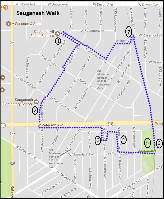
Sauganash Walk
The land where Sauganash stands was inhabited by Native Americans in the early 19th Century. The name “Sauganash” comes from Billy Caldwell, the Potawatomi son of a Mohawk mother and British officer father. Given the name “Chief Sauganash,” meaning Englishman, Caldwell mediated treaties between the Native Americans and the United States.
As thanks for his diplomacy, in 1828 the government gave him the nearly two-and-one-half-square-mile area that is now occupied by Sauganash and Edgebrook. This 1,600-acre parcel of land stretched along both sides of the Chicago River—crucial for food, water and transportation—which accounts for the diagonal street pattern.
In 1912 a small portion of the Billy Caldwell Reserve, 260 acres, was purchased by one of the oldest and most respected real estate firms in Chicago, Koester and Zander, and named “Sauganash,” to denote the area’s history. While the first eight homes on Kostner Avenue between Peterson and Rogers Avenues were completed by 1924, two hundred homes were completed by 1930.
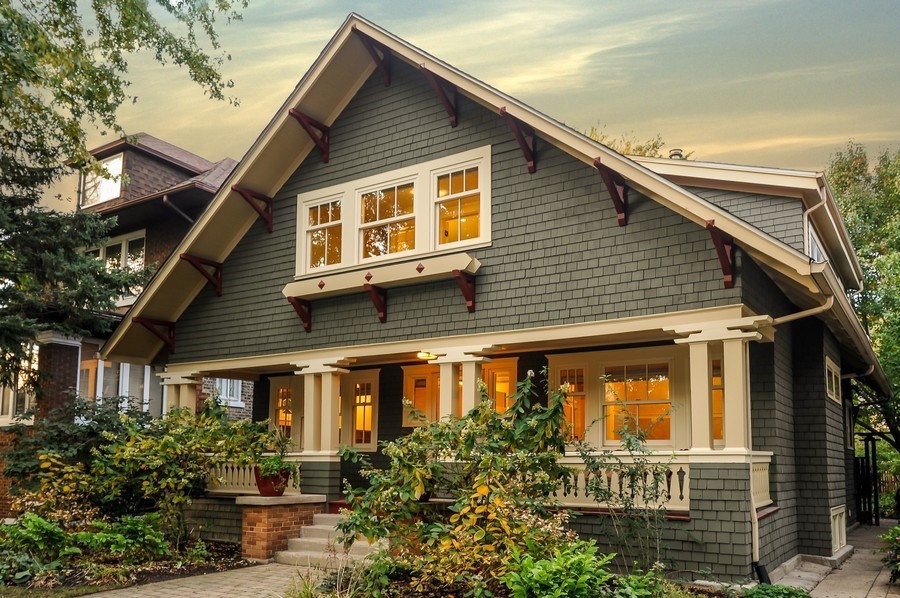
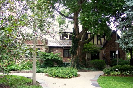
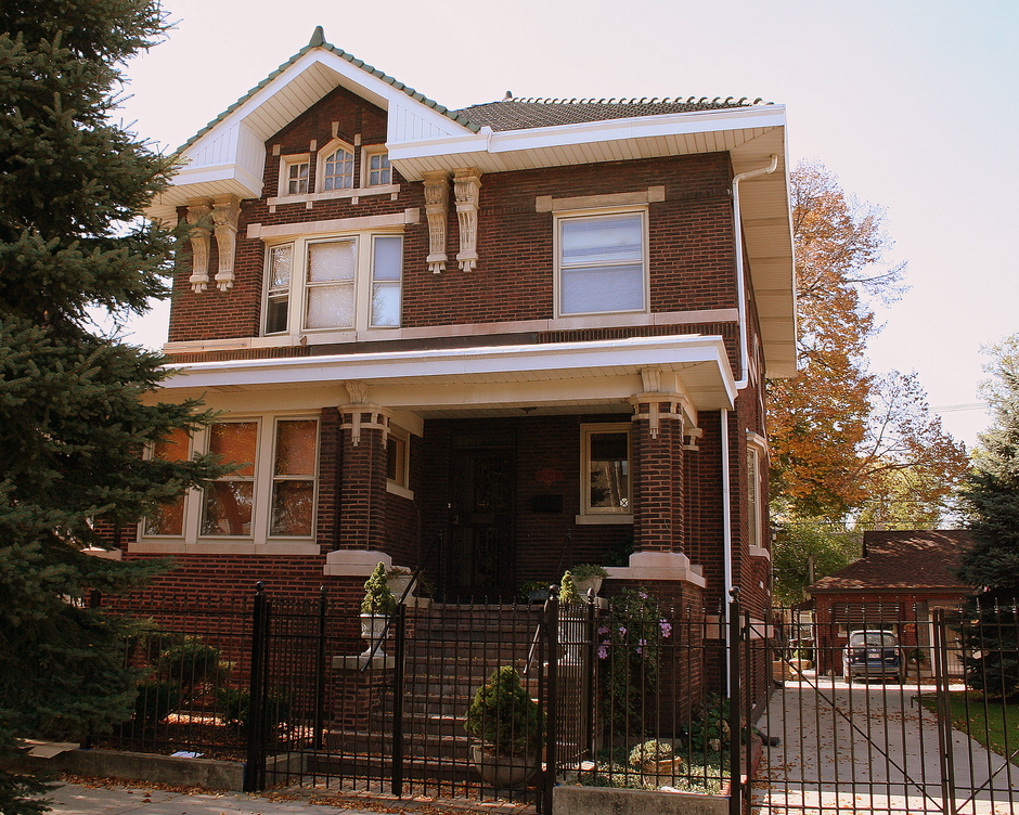
Sauganash is a blend of several distinctive architecture styles, ranging from bungalows and Cape Cod cottages to the palatial French and Classical Revival designs, as well as Art Deco and Art Moderne. The principal architectural style is Tudor Revival.
Koester and Zander laid the foundation for Sauganash’s distinctive green space by planting more than 20 varieties of trees, including oak, sycamore and mountain ash, lending to the lush character of the community. By the 1930s, census records show the area catered to upper middle-class families.
(Info from the Sauganash Chamber of Commerce website)
Part of Sauganash is a National Historic District and that is where our walk takes us today. As original Art Deco and Art Moderne homes are so rare to see, we’ve selected this style to show you on the walk. There are many architectural styles represented in the district and they are itemized in the Sauganash National Historic District Info . You may want to use it as a guide as to design your own walk through the district to architectural styles you are most interested in.
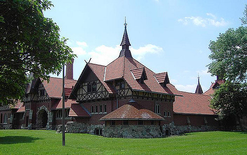
Park near Queen of All Saints to start the walk
- Queen of All Saints Basilica 6280 N. Sauganash Ave.
An important Sauganash landmark is Queen of All Saints Basilica. The church, designed in a Neo-Gothic style by Meyer and Cook, was completed in 1960. The magnificent, cathedral-like church was raised to the dignity of a basilica by Pope John XXIII on March 26, 1962. The large window over the choir loft features eight different shrines of the Virgin Mary, each particular to a certain country or culture representing the different ethnic groups living in Sauganash. (from The Sauganash Chamber of Commerce website)
- Sauganash Elementary School 6040 N. Kilpatrick Ave.
This school was built by the Works Public Administration (WPA) in 1936. Designed by John C. Christensen, the long-time architect for Chicago Public Schools, this two story brick and terra cotta school is a good example of New Deal-era Art Deco public architecture. Situated on 2.5 acres, the Sauganash Elementary School and its grounds provide recreational and green space for residents. (From the National Register of Historic Places Registration Form)
- Art Deco Residence 5928 N. Kilbourn
Described by the Chicago Daily Tribune as “a residence said to reach the zenith of modernism,” the house here was perhaps one of the earliest Art Deco small homes in the nation. Built by Herman Voss, the house features many typical Art Deco elements. Vertical lines are emphasized all along the front elevation, both in the long rectangular windows, and in the ornamental pilasters that frame two round windows. Decorative elements, such as the detailing at the corners of the wall below the roofline, add to the Art Deco feel of the house. (From the National Register of Historic Places Registration Form)
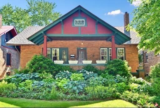
- Art Moderne Residence 5915 N. Kenneth
Inspired by streamlined industrial design, the Art Moderne style developed following Art Deco in the 1930s. Rather than building upon elements of the past as Art Deco had, Art Moderne was an attempt to create a glimpse into an exciting future during the Great Depression. The style is characterized by horizontal lines and rounded corners designed to simulate a feeling of movement. Architects also borrowed many elements directly from the transportation industry, such as chrome and circular windows. Because it was based on already familiar designs, Art Moderne was more accepted as a residential style. In addition, Art Modern lent itself well to remodeling projects, allowing budget conscious consumers to update their homes in the latest style.
The house here on Kenneth provides an excellent example of the Art Moderne design. The house is constructed of brick, with accent bricks set to create horizontal lines that appear to trail off after the windows. Round porthole-style windows are placed in the front door and entryway. A rounded wall of glass bricks at the south end of the house is a unique feature, reinforcing the streamlined appearance of the house. (From the National Register of Historic Places Registration Form)
- Sauganash Park 5861 N. Kostner Ave.
The single story English style fieldhouse dates back to 1934. In the mid-1970s, a large gymnasium was added to the fieldhouse. Because the addition detracts from the design, materials and feeling of the original Tudor-style field house, the fieldhouse is a non-contributing resource in the Sauganash Historic District.
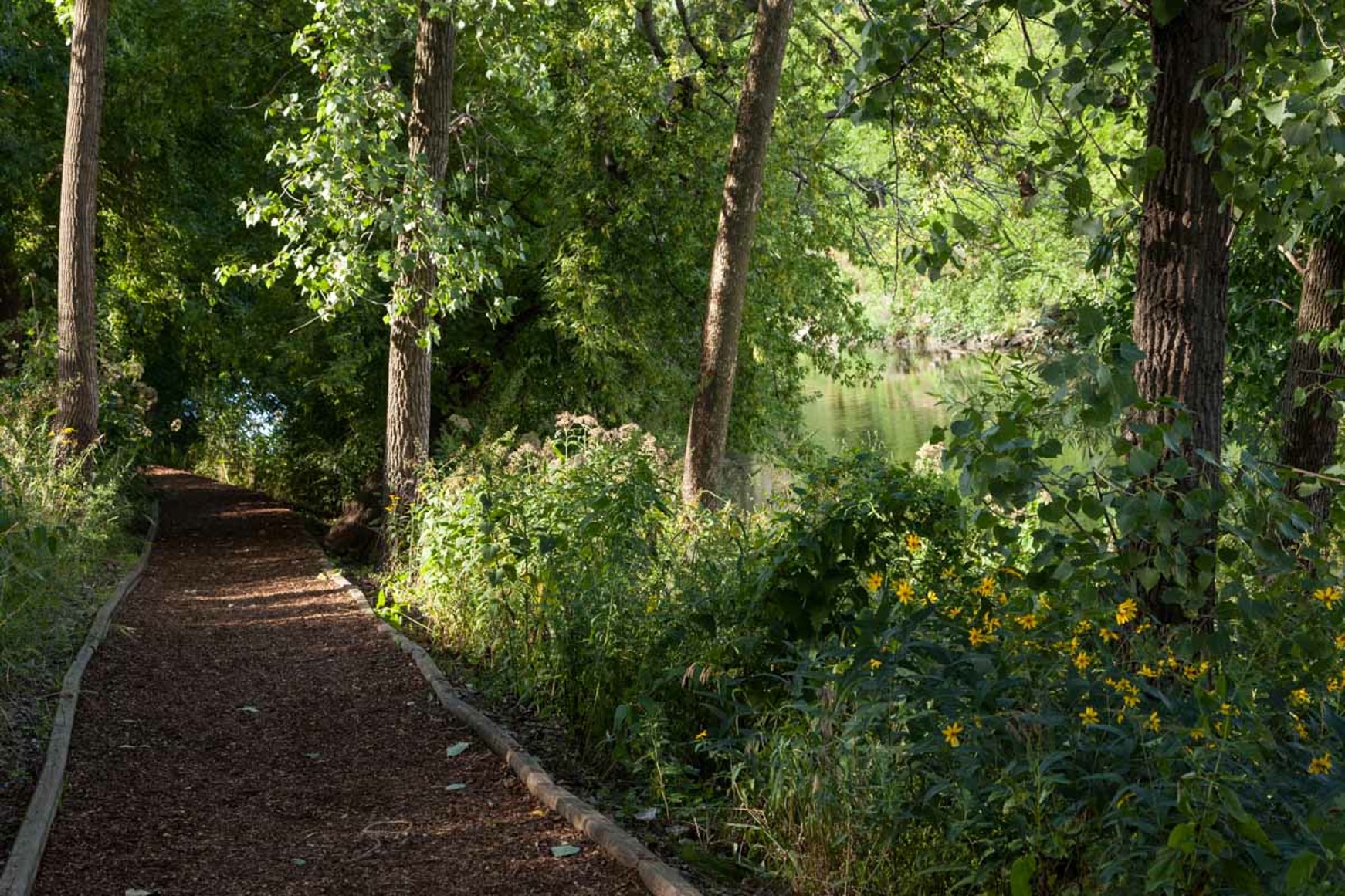
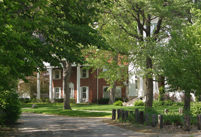
- Sauganash Trail Park Access the trail east of the park
The Sauganash Trail officially opened June 21, 2008. It’s one mile long, running from Bryn Mawr to Devon near Kostner. It’s a wonderful little path that is used regularly by locals. Community residents can access the path at Bryn Mawr to pedal downtown, take a leisurely stroll or power walk, walk their dog, or take jog in the neighborhood.
Enter the trail at the park, enjoy a brief half mile stroll, and exit at the first access point you see.
- You will emerge onto W. Thome Avenue.
Follow the map or wander around more of these lovely streets to return to your car.
After returning to your car, drive over to Old Edgebrook
Old Edgebrook Walk
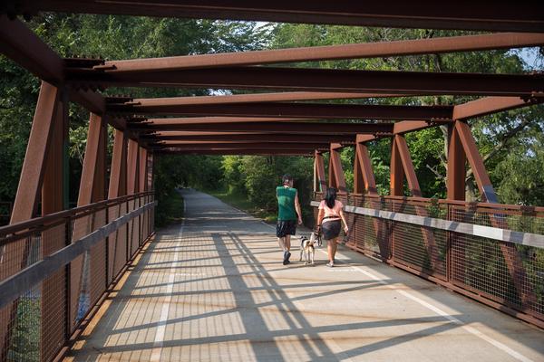
Planned originally in 1894 as a neighborhood for executives of the Milwaukee Road Railway Co., Old Edgebrook is rich in architecture, history and rustic charm. There are just 48 homes in this small community with winding, heavily forested streets. The architecture represents almost every style popular with middle and upper middle class families in the 1890s through the 1940s.
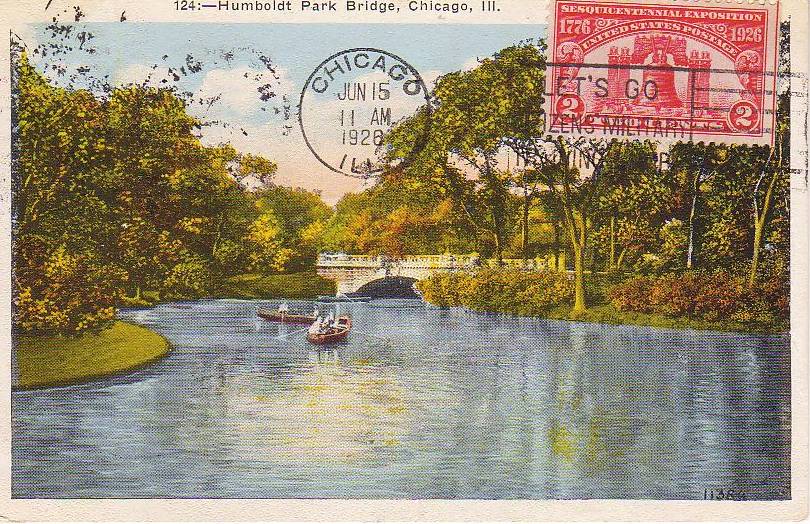
Wildlife abounds as the neighborhood is surrounded by the Edgebrook Golf Course, Cook County Forest Preserve and the Chicago River. The two roads leading in and out are heavily wooded, adding to the secluded feel of the area.
This neighborhood became a Chicago Historic District in 1988.
The route plotted through the neighborhood is entirely random, so meander as you wish to the only item on the walk that I have listed.
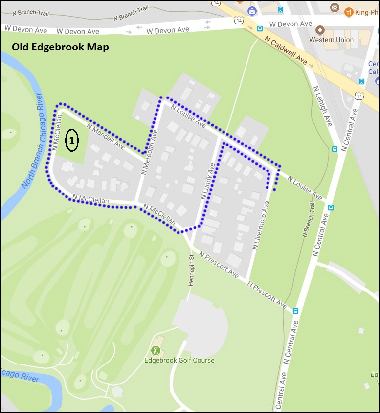
- Mary Burkemeier Quinn Park of Trees (aka Quinn Park) 6239 N. McClellan Ave.
- This is one of the smallest Chicago Park District Parks. When Edward Quinn died in 1980, he left their property to the Chicago Park District for a park to be named after his wife. Under the terms of the bequest, he instructed that his house be demolished and a minimum of 21 trees be planted on the site. In 1988, the wooded park became part of the City of Chicago’s Old Edgebrook Historic Landmark District.