Month: June 2017

East Humboldt Park

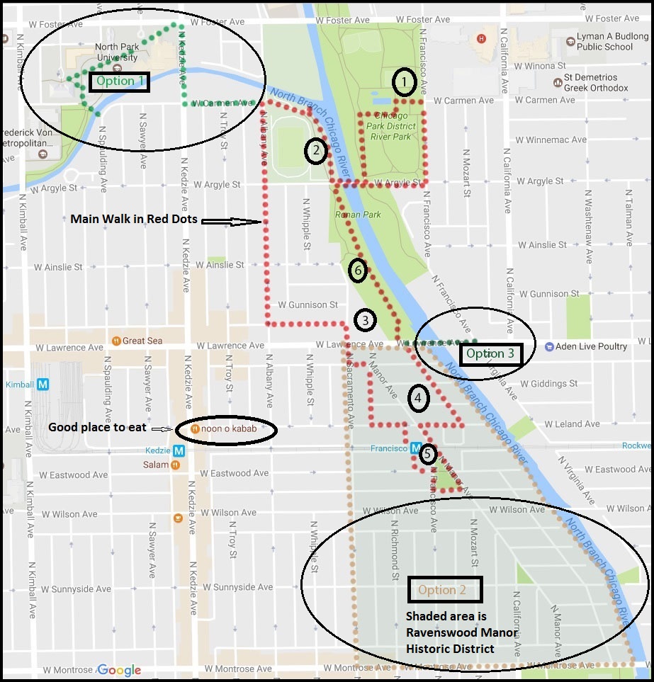
Length of Walk: 2.7 miles

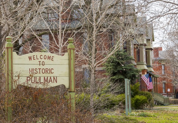
Where it is located:  East Humboldt Park is actually a neighborhood on the west side of the West Town Community Area. It includes Humboldt Park and the famous Puerto Rican “Paseo Boricua”, which are the focuses of this walk. It is Walk #13 on the Walks Location Map.

Humboldt Park Receptory Building and Stable, home to the National Museum of Puerto Rican Arts and Culture

How we got there:  We drove and parked inside Humboldt Park at the start of the walk. We entered on N. Albany off North Avenue just east of the Armory and found a spot right away. You can check out your public transportation options with the CTA Trip Planner.

from Chuckman’s Photos

Marge’s Comments: It’s been a couple of years since we took this walk, but what I remember most is feeling wistful that I had never seen the park at the peak of its glory, probably in the mid 1900s. Its bones are magnificent and the restoration of the Stables is a must see. The lagoons, gardens and fieldhouse are mere shadows of their former selves but still impressive. Emerging from the park onto the Puerto Rican Paseo Boricua is a lively change of pace with vibrant street life, colorful murals and ethnic eateries.

Puerto Rican Flag on Paseo Boricua (Division St.)


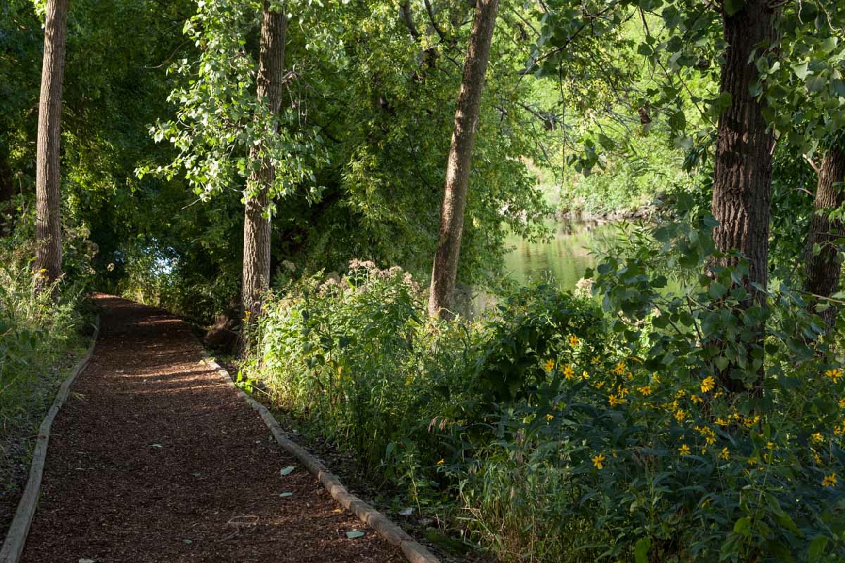
Ed’s Comments: This walk is more of a park walk than a neighborhood walk as most of the mileage is within Humboldt Park.   Nevertheless, you couldn’t find a more delightful inner-city park just a short distance from all the interesting neighborhoods on the near west side of town.  The ponds, pavilions, trails, and formal gardens are a delight most months of the year. Don’t miss the Puerto Rican Heritage Museum in the old horse stables south of Division Street.


Printable PDF of the Walk:  Chicago Neighborhood Walk East Humboldt Park

The Walk:


East Humboldt Park Walk

This neighborhood has followed the pattern of so many Chicago neighborhoods. It has seen successive waves of immigrants, lured by rail access and factory work. Germans, Scandinavians, Poles, Jews and Italians lived here around the turn of the 20th century. As the century progressed, they migrated elsewhere. The area deteriorated and fell victim to gangs and decline.

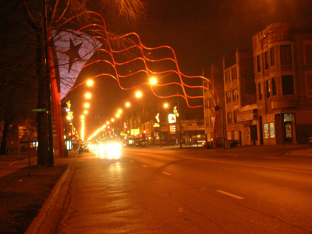
The latter half of the century saw the area as a Latino “port of entry” neighborhood. Puerto Ricans and Mexicans comprised about 62% of the population by 1990. There were periods of riots and unrest among the Puerto Rican community because of police treatment of its residents. In 1995, Division Street found new life when city officials and Latino leaders decided on a public art project to recognize the neighborhood and the residents’ roots. They christened it “Paseo Boricua” and installed two metal Puerto Rican flags—each weighing 45 tons, measuring 59 feet (18 m) vertically and stretching across the street—at each end of the strip.

This is considered the flagship of Puerto Rican enclaves in the United States and is the political and cultural capital of the Puerto Rican community in the Midwest. It is home to a cultural center, colorful murals, vibrant street life and music, and a yearly festival and parade.

The neighborhood is changing once again. Gentrification has brought higher real estate values and taxes and poorer residents are getting edged out. Latino makeup has fallen to 47% and is declining.

Humboldt Park (the Park) is on the National Register of Historic Places and the Boathouse and Stables are designated Chicago landmarks.

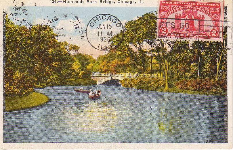
History of Humboldt Park, the Park: (from Wikipedia) William Le Baron Jenney began developing the park in the 1870s, molding a flat prairie landscape into a “pleasure ground” with horse trails and a pair of lagoons. The park opened to the public in 1877, but landscape architects such as Jens Jensen made significant additions to the park over the next few decades. Between 1905 and 1920, Jensen connected the two lagoons with a river, planted a rose garden, and built a fieldhouse, boathouse, and music pavilion. There is an audio tour on the Chicago Park District website of the park that gives more history and information. (The walk is also available at Tour Budy.)

At the request of the largely German born population at the time, the park was named after Baron Freidrich Heinrich Alexander Von Humboldt (1759-1859), the famous German scientist and explorer, though Humboldt had only visited the U.S. once and had never been to Chicago.

1.) Humboldt Park Fieldhouse 1400 N. Sacramento

In 1928, the West Park Commission constructed a fieldhouse in Humboldt Park. The structure was designed by architects Michaelsen and Rognstad, who were also responsible for other notable buildings including the Garfield Park Gold Dome Building, the Douglas and LaFolette Park Fieldhouses, and the On Leong Chinese Merchant’s Association Building in Chinatown.

2.) Boathouse 1301 N. Sacramento

Jens Jensen commissioned Schmidt, Garden, and Martin to design an impressive boat house and refectory building (1907) which still stands at one end of the historic music court. There is a café here which has outdoor seating and pretty views of the park.

3.)  Bison Bronzes at the Formal Garden

The two bison at the Formal Garden were sculpted by Edward Kemeys who also created the lions in front of the Art Institute.

4.)  Formal Garden

Jens Jensen created this garden in 1908. It once featured semi-circular beds of roses and other perennials, as well as an upper terrace with wooden and concrete pergolas, according to the Jensen Formal Garden Restoration Project website.

“He called it a ‘community garden’ explaining that it was created for ‘those who have no other gardens except their window sills,'” the website reads.

Over the years, the garden has deteriorated: the concrete walls and pergolas are cracking, the wood is rotting, some flowers beds have been sodded over and very few flowers remain, according to the website.

DNA Info reported on May 2, 2017 that the prominent Dutch designer behind the award-winning Lurie Garden in Millennium Park has been tapped to revitalize the garden.  Plans include repairing the crumbling infrastructure and revitalizing the design features in keeping with Jensen’s famous Prairie style.

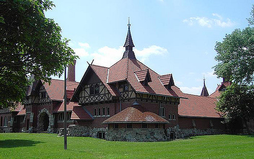
5.) Humboldt Park Receptory Building and Stable                     3015 W. Division

This beautifully restored building houses the only year round museum dedicated to Puerto Rican arts and culture, the National Museum of Puerto Rican Arts and Culture. It has received 23 million dollars in renovations over the last several years. The Chicago Landmark Commission report describes the building’s appearance as “old German style of country house architecture” which looks vividly picturesque within the greenery of Humboldt Park. It was built in 1895 to house horses, wagons and landscaping tools.

It was designed by Frommann and Jebsen and also served as the office of the Humboldt Park Superintendent, Jens Jensen, whose office was in the turret. It is the oldest surviving building in Humboldt Park.

The rest of this tour is taken verbatim from the Humboldt Park Mural Tour created by architreasures, an arts based community development organization.

6.) Paseo Boricua Gateway Flags, 1995        One flag at Western and Division and one flag at California and Division

Each flag weighs 45 tons, measures 56’ high, and forms a 59’ arch from one side of the street to the other. They are made out of steel and steel pipeline welded together. The flags were made out of steel to honor the first wave of Puerto Rican immigrants who established themselves in Chicago and the Midwest to work for its steel industry in the mid-1940s. The second wave of Puerto Ricans came specifically to work on steel pipelines, the material the flags are made out of. These flags act as the gateway to Paseo Boricua, the portion of Division Street between these flags.

7.) Co-Op Image Graffiti Mural, 2011 Co-Op Image                   2750 West Division St.

This graffiti style mural reflects the vitality of life on Division Street.The mural confirms that graffiti can be an art form and not just vandalism. The graffiti mural was legally sanctioned by an auto-mechanic shop that gave the organization permission to paint. The image in the center is from a photograph taken on April 16, 1936. Albizu Campos is rallying a crowd to become a force for independence.

8.) Born of Fire, 2006 Martin Soto                                                2700 West Division St.

This mural is a complicated narrative about the Puerto Rican community in Chicago. It contains images about education, culture, sports, gang violence, and Puerto Rican historical figures. The mural reflects community, social, and political concerns as well as neighborhood history and achievements with specific reference to the 1996 Division Street Riots and the Three Kings Festival. After the Riots, the community became more politically active and vibrant. Puerto Rico’s national flower, the maga, or hibiscus flower is depicted.

9.) La Casita de Don Pedro, 1998 archi-treasures, Dr. Pedro Albizu Campos High School, Puerto Rican Cultural Center of Chicago 2625 West Division St.

This is a park dedicated to Humboldt Park’s Puerto Rican community designed to look like the Puerto Rican flag from above. Three red tiled stripes lead to the base of the statue, which is shaped like a star. “La casita” or “little house,” is a replica of a 1940s typical rural house in Puerto Rico with a zinc roof and a porch. The statue of Don Pedro Albizu Campos located in the center of the park was originally intended to be installed in Humboldt Park but was rejected by the Chicago Park District because Albizu Campos was thought to be too controversial. The park hosts bomba and plena dance and drum classes, political rallies, concerts, art exhibits, and other events. La Casita de Don Pedro was one of archi-treasures’ pilot projects completed in 1998.

10.) Honor Boricua, 1992 Hector Duarte                                        1318 North Rockwell St.

The mural honors the Puerto Rican heritage of many people in Humboldt Park. The flag flying across the sea from Old San Juan, Puerto Rico to Chicago and back represents the ongoing exchange of culture, resources, people, and ideas between the communities. The mural illustrates transnational and multicultural messages. The artist interviewed community members about their stories and used their ideas to develop the theme for the mural. Borinquen is the original Taíno Indian name for the Island of Puerto Rico.

11.) Breaking the Chains, 1971 John Pitman Weber                           1500 North Rockwell St.

The mural is about community struggles. There are hands breaking the chains of poverty, racism, and war and holding up children carrying roses in a bright light that symbolizes a bright future for the next generation. The woman crying from the burning window is a reference to the arsons that plagued the community in the early 1970’s when landlords began burning buildings to collect the insurance on them.

If you want to see more murals, follow the aqua dotted line on the map and see more murals at stops A through F.

A.)  La Crucifixion de Don Pedro Albizu Campos, 1971 Mario Galan, Jose Bermudez, Hector Rosario                                          2425 West North Ave.

Don Pedro Albizu Campos, the leader of the Puerto Rican Nationalist Party, is depicted crucified in the center alongside two other Nationalists of the 1950s. Portraits of six independence and abolitionist leaders of the 19th century are lined across the top. The flag in the background is called the La Bandera de Lares. It represents Puerto Rico’s first declaration of independence from Spain on September 23, 1868. This armed uprising is known as El Grito de Lares. It took nine years to save this mural from destruction. A new condominium was planned and if built, would have blocked off the mural. Community members concerned about gentrification of the neighborhood as well as saving the oldest Puerto Rican mural in Chicago went into action and saved it.

B.) I Will… The People United Cannot Be Defeated, 2004 Northeastern Illinois University Students                                     1300 North Western Ave.

The mural is sending a message that encourages people to vote. It depicts the activist figures Mother Jones, Fred Hampton, Eugene Debs, and Lucy Parsons. The mural reflects the mass mobilization of people to exercise their right to vote and to become active leaders toward positive social change. The title of the mural comes from a chant first heard at a Chilean protest.

D.) 79th, 2009 John Vergara                                               2460 West Division St.

This mural depicts the recently designed Paseo Boricua flag that recognizes Humboldt Park as the heart of the City’s Puerto Rican community. The symbolism in the Coat of Arms connects Puerto Rico and its culture to the City of Chicago. Paseo Boricua is the first location outside the Commonwealth of Puerto Rico to be granted the right to fly an official Municipal Flag of Puerto Rico. The reason this mural is titled “79th” is that there are 78 municipalities in Puerto Rico and Paseo Boricua has the honor of being named the 79th.

E.) Sea of Flags, 2004 Gamaliel Ramirez with assistance from Star Padilla, Moncho, Luis Ortiz, Melissa Cintron, and community members                                     2500 West Division St.

The mural depicts a cultural/music event called Fiesta Boricua (De Bandera a Bandera). The Festival attracts over 250,000 people every year and is held in September. Visitors can hear salsa, reggaeton, bomba, plena, and merengue music pulsing in the streets. The mural depicts some famous people including National Puerto Rican icon Lolita Lebrón, Pedro Pietri, and Don Pedro Albizu Campos, the leader of the Puerto Rican Independence Movement who is depicted as a bronze statue on the left of the image. The abundance of Puerto Rican flags is an intentional comment by the artists. From 1898 to 1952, when Puerto Rico became annexed by the United States, it was considered a felony to display the Puerto Rican flag in public; the only flag permitted to be flown on the island was the United States flag.

F.)  Escuelita Tropical, 2005 Eren Star Padilla                                               2516 West Division St. This is one of the few murals in the area created by a female artist. Symbols on the mural refer to Taíno petroglyphs and pictographs found in the Caribbean as well as Aztec symbols from Mexico. The symbols are Pre-Columbian and speak to the cultural identity of the Puerto Rican and Mexican children of Viva Child + Family, the child development center that owns the building where the mural is located.

Drive By Add On:

Some may remember the terrible school fire at Our Lady of Angels on December 1, 1958. Those of us alive at the time will never forget the tragic images of the fire that killed 92 children and 3 nuns. The replacement school closed and is now leased to a charter school, but there is a memorial on site at 3808 W. Iowa St., a close drive from this walk.

Resources: Wikipedia, Encyclopedia of Chicago, Chicago Park District,


Pullman

Length: 1.5 miles

Where it is located: This walk takes you through the heart of the Pullman historic district in the community area of Pullman. It is Walk #12 on the Walks Location Map.

How we got there:  We drove and parked at the Visitor Center. There is also street parking in the neighborhood. The Visitor Center provides detailed options for travel via car, bus and train.

Marge’s Comments:  This was one of the first neighborhood walks I took after moving to the city in 2005. I was fascinated by the history of Pullman and knew that much of the “town” exists intact from when it was built in 1880 – 1884. Walking among the well preserved row homes once occupied by the workers of the Pullman factory helps you envision what life in Chicago may have been like over 100 years ago. The Visitor Center is a must see and greatly enhances your experience. The factory is a burned out hulk of a building and other sites are in shambles, but the future looks hopeful. The area has been gentrifying since the late 1900s, the district was declared a National Monument in 2015 and the commitment to restoration among community groups gives hope that the area will one day be restored fully.

Ed’s Comments:

The Pullman neighborhood is a spectacle: one part ruins and one part rising Phoenix. The ruins of the manufacturing complex that was absorbed by Chicago over a century ago is a humble reminder of man’s fate.  In the adjoining neighborhood, once owned by the company, urban frontiersmen have made a delightful and safe haven for themselves.  Down 111th Street and across I-94 the magnificent Harbourside Gold Course offers 36 holes, each with a breathtaking view of Chicago in the distance.

Pullman Workers


Before we get started: 

This walk is very limited in that it takes place in the very tight area around the visitor center.  If you are inclined to wander beyond it, please ask at the visitor center where to go, what to see and what is safe. They are very knowledgeable about the area and are very helpful.

There are guided walking tours of Pullman on the first Sunday of every month from May to October. In addition, there is an Annual Historic Pullman House Tour weekend, where homes and sites in Pullman are open to the public. This is fabulous and gives you a chance to see inside some beautifully restored houses as well as the Florence Hotel and other historical sites. Highly recommended! However, if neither of those options fit with your schedule, you will still enjoy going to the Historic Pullman Foundation Visitor Center, browsing their exhibits and taking the self-guided walking tour with the map they provide. This map is reproduced here and makes up our walk for Pullman.

Printable PDF of the Pullman Walk: Chicago Neighborhood Walk Pullman

The Walk:

Pullman Historic District

This walk covers only the Pullman Historic District, also known as the Pullman National Monument. It was the first model, planned industrial community in the United States. The district is significant for its historical origins in the Pullman Company, one of the most famous company towns in the United States, and scene of the violent 1894 Pullman strike.

Historic Pullman was built in the 1880s by George Pullman as workers’ housing for employees of his eponymous railroad car company, the Pullman Palace Car Company. He established behavioral standards that workers had to meet to live in the area and charged them rent.

Pullman’s architect, Solon Spencer Beman, was said to be extremely proud that he had met all the workers’ needs within the neighborhood he designed. The distinctive row houses were comfortable by the standards of the day and contained such amenities as indoor plumbing, gas and sewers.

During the depression that followed the Panic of 1893, demand for Pullman cars slackened. Despite cutbacks and wage reductions at the factory, the Company did not reduce rents for workers who lived in Pullman. Workers initiated the Pullman Strike in 1894 and it lasted 2 months, eventually leading to intervention by the U.S. Government and military.

After George Pullman died in 1897, the town was annexed by the city of Chicago and the city sold the houses to their occupants. Deindustrialization and migration to the suburbs led the area to fall into decline and a proposal to demolish the area to create new industrial development was defeated by the efforts of its residents.

Over the years local organizations and foundations have fought and won for recognition of Pullman as a Historic District and all the protections that brings.

From Wikipedia and Historic Pullman Foundation


Resources: Historic Pullman Foundation, Philip Randolph Pullman Porter Museum,  Pullman, the Town


East Albany Park and Ravenswood Manor

Length of Walk: The main walk is 2.4 miles. I’ve listed 3 optional excursions off the main walk. They include an extended walk in Ravenswood Manor, a trip to North Park University and a visit to the Cambodian Association.

Where it is located: This walk will take you to the east side of Albany Park Community Area. It is Walk #11 on the Walks Location Map.

Ronan Park Path along the River

How we got there: We drove and parked on N. Francisco in front of the River Park Fieldhouse. Parking can be tight in this neighborhood. The Brown Line is a great option for getting here. Take it to the Francisco station (which is part of this walk) and start the walk at Stop #5 and make the loop. You can check out other public transportation options with the CTA Trip Planner.

Carpet Mosaic at the Francisco Brown Line Station

Marge’s Comments: After walking this community, I wondered why it had taken me so long to discover it. The nature areas and parks, the charming historic district of Ravenswood Manor and the diversity of nationalities here make this walk a visual and cultural delight. If your exposure to this neighborhood has been using Lawrence Avenue as a thoroughfare to someplace else, stop, park the car and start exploring. You are in for a wonderful surprise.

Ed’s Comments: This is an easy walk and easy to get to but filled with so much local neighborhood interest. Although the bucolic north branch of the river is the spine of this area, the blocks are filled with newly arrived immigrants and stately old homes and bungalows.  Try going and coming on the CTA Brown Line and feel what it is like to travel and live in this peaceful enclave.

Printable PDF of the Walk: Chicago Neighborhood Walk Albany Park and Ravenswood Manor

Charming home in Ravenswood Manor

The Walk:


This walk takes you to the very eastern part of Albany Park and even spills slightly over the border into North Park and Ravenswood. The western part of Albany Park is home to North Mayfair, another historic district, and will be the focus of another walk.

East Albany Park and Ravenswood Manor

German and Swedish immigrants initially settled the Albany Park area. After 1912, the area became home to a large number of Russian Jews and remained predominately Jewish through the 1950s. After the Second World War, many Jewish families moved north to Lincolnwood and Skokie. The suburban exodus led Albany Park into economic and social decline. In the 1970s, 70% of the commercial property along Lawrence Avenue stood vacant. Empty buildings attracted illegal drug trade, prostitution and gangs.

Relief came in 1978 when the city government, the North River Commission and the Lawrence Avenue Development Corporation cooperated to improve Albany Park’s appearance and business development.

After the 1970s , Albany Park became a port of entry for immigrants from Asia and Latin America and today it is one of the most ethnically diverse zipcodes in the United States. Over 40 languages are spoken in its public schools.

(from Encyclopedia of Chicago and Wikipedia)

Main Walk (marked in red dots on the map)

1.River Park 5100 N. Francisco Ave.

Chicago architect Clarence Hatzfeld designed the impressive brick fieldhouse with a three-story central section and a long wing on either end. It was constructed in 1929 to replace the original structure.

Special note: There is an interesting Potawatomi Village mural in the fieldhouse.  It was donated to Potawatomi Park on the North side by 10 students who were taking Potawatomi Art Class.  The painting depicts Chief Alexander Robinson, who wears an American style suit, talking with two Native Americans in tribal garb, in the midst of a bustling Potawatomi village. The son of a Scottish fur-trader father and Potawatomi mother, Chief Alexander Robinson (1787–1872) was instrumental in negotiating several early-nineteenth-century treaties between Native Americans and the United States government. In return for persuading tribal members to peacefully abandon the area, the federal government granted Robinson a two-square-mile property west of Chicago. The chief’s family occupied this land for many decades. When the art students decided to paint the village scene, Robinson’s granddaughter granted them permission to use the property to help create the painting. Today, the land is part of the Robinson Reserve, part of the Cook County Forest Preserve.

First displayed at Potawatomi Park, the painting was removed sometime after the demolition of the park’s original field house. In 2008, after the Chicago Park District had it fully conserved, the mural was moved to the auditorium of the River Park field house.

River Park is located at the convergence of the Chicago River and canal and offers a rich wildlife habitat, excellent fishing and a canoe launch. It has a swimming pool and an interactive water playground in the summer months.

The artificial turf soccer field and running track, as well as a soft-surface playground, draw visitors from around the city. The park also features seven tennis courts and two baseball fields.

2.Dam and Waterfall: Cross the river to the west side of the park and walk north to where the river splits. You will find the only dam and waterfall in the city of the Chicago. You will see what appears to be an abandoned little path in the bushes that line the river where it turns west after the dam. It is short, but interesting.

After you’ve explored the park, meander over to Lawrence and Sacramento to

3.Global Gardens, 2954 W. Lawrence: This empty lot was transformed into a vibrant farm where over 100 refugee families grow vegetables. This provides refugees access to fresh vegetables as well as reconnects displaced farmers with soil and food production. They also sell their vegetables at the Horner Park Farmers Market nearby. Visitors are welcome, so walk right in and look around. In addition to seeing thriving and abundant vegetable plots, you will notice gardeners of every race and nationality. You can enter through the main entrance on Sacramento, walk through and exit at a gate in the middle of the garden on Lawrence.

4.Ravenswood Manor: Ravenswood Manor is on the National Register of Historic Places because 96% of its buildings were constructed between 1909 and 1933 and are intact today. Ravenswood Manor represents architectural trends and urban residential neighborhood development in Chicago in the early 20th century. Chicago Bungalows and American Foursquares sit alongside high end architect designed, historic revival style residences. What also makes it so charming is its location along the river. Early brochures touted it as a “Motor Boat Colony” complete with a club house for the perpetual use of its residents. Resources for a more in depth look at this area are listed in Option 2.

5.Francisco Brown Line Station, 4648 N. Francisco : This station was built in 1907 and became the impetus for the development of Ravenswood Manor. It is all original except for its doors which needed to be widened to comply with ADA requirements. Ellen Harvey’s “Carpet” mosaic of hand cut marble on the ramp in and out of the station looks like an oriental carpet and it is a beautiful and welcoming transition into the community. The tracks are on grade and the station feels like a train stop in a small community. This is further enhanced by all the cute coffee and sandwich shops that sit right next to the station and patronized by commuters, residents and families.

Make your way back to Lawrence just west of the river. Cross Lawrence and enter Ronan Park. Take the wood chip path along the river and head north.

6.Ronan Park Restored in 2002, the Ronan Park includes 3 acres of naturalized river edge habitat along the North Branch of the Chicago River. A wood chip path in the park parallels the river, making Ronan Park a perfect spot for bird watching or a nature walk.

Across the river near Lawrence, you will notice a large, elegant, Art Deco building you might mistake for a fieldhouse. It is actually the North Branch Pumping station, a sewage pumping station built in 1929.

Ronan Park honors Ensign George Ronan, who died in the Fort Dearborn Massacre on August 15, 1812, when Potawatomi warriors routed the Federal forces at Chicago. Ronan was the first West Point graduate to fall in battle.

Optional Excursions:

1.North Park University, 3225 W. Foster: North Park University’s roots reach back to a Minneapolis church basement in 1891, where classes in language, and business gave Swedish immigrants the education and skills they needed to prosper in America. With an offer of land in Chicago, the school moved to the North Park neighborhood just beyond the city limits.

Old Main, the first building on campus, was completed in 1894. The Georgian Revival structure housed all departments of the school, from classrooms, library, and faculty offices to sleeping quarters, gymnasium, and dining room. In the Twenties, pilots used the cupola atop Old Main as a landmark by which to locate Orchard Field (now O’Hare International Airport). The cupola was the tallest point on the city’s north side.

From the beginning, North Park has expanded and adapted its educational mission to the times. At various points in its history, North Park was an academy, junior college, and four-year liberal arts college. They became a university, with a theological seminary, in 1997.

Campus facilities have been extensively renovated, including the LEED-certified Johnson Center for Science and Community Life, opened in 2014; the 2006 addition of the Helwig Recreation Center; the 2004 construction of the Holmgren Athletic Complex for football, softball, and baseball; and the 2001 construction of the Brandel Library.

We enjoyed walking this pretty and well maintained campus.

A Map of the University and more information can be found at their website: https://www.northpark.edu/

2.Ravenswood Manor Historic District: This historic district is shaded in pale green and will be interesting no matter where you roam within it. However, there are several walking tours of the district outlined on the Ravenswood Manor Improvement Association website: http://ravenswoodmanor.com/walking-tours/. Also there is a listing of all the homes in the historic district in the National Historic Landmark application: http://ravenswoodmanor.com/wp-content/uploads/2014/04/NationalRegisterHistoricDistrictApplication.pdf

3.Cambodian Association 2831 W. Lawrence: A walk through the museum and memorial is very moving as the story of the Civil War in Cambodia, especially the Khmer Rouge Regime of 1975 – 1979, is told through multimedia displays, archives, narratives and artifacts.

Resources: Wikipedia, River Park, Ronan Park, Global Gardens, Cambodian Association of Illinois