Category: Neighborhood (Alphabetical)

West Ridge

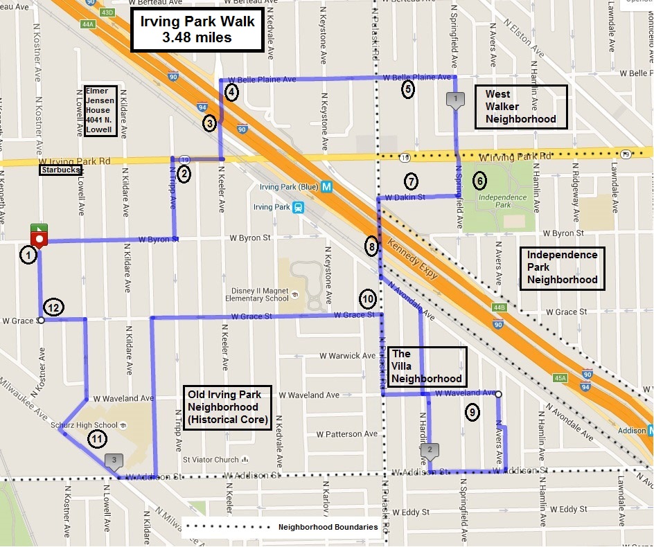
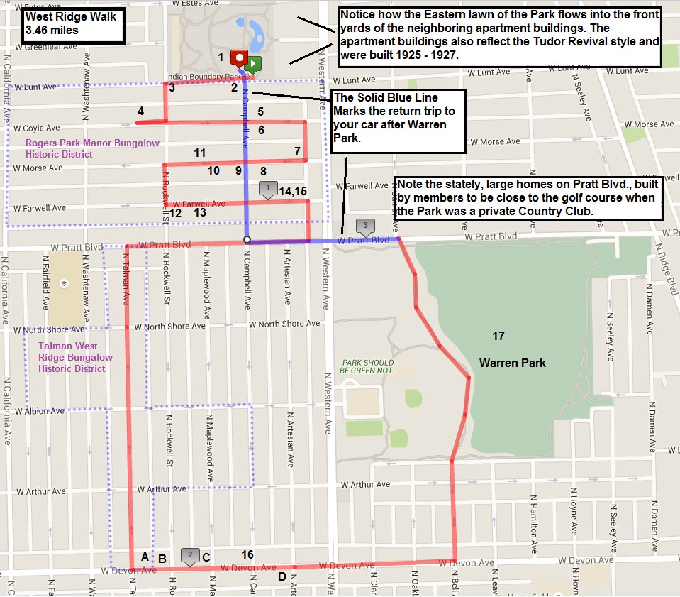
Length of Walk: 3.46 miles (about a two hour walk)

Where it is located: West Ridge is one of the 77 Community Areas of Chicago. It is directly west of Rogers Park and is often referred to as West Rogers Park. It is marked by number 4 on the Walks Location Map.

Indian Boundary Park
Indian Boundary Park Fieldhouse

How we got there: We drove and parked on Lunt Avenue across from the first stop on the walk, Indian Boundary Park at 2500 W. Lunt. You can also check for public transportation options at CTA Trip Planner.

Bungalows
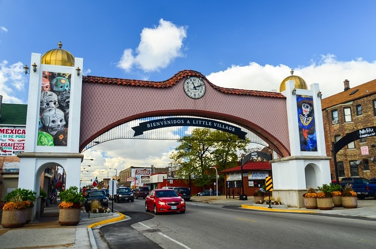
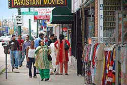
Marge’s Comments: I was lucky enough to come upon an architectural walking tour of the Rogers Park Manor Historic Bungalow District that I used in this walk. Bungalows are ubiquitous in Chicago, yet I never knew much about their evolution or role in the history of Chicago. There are still 80,000 bungalows in Chicago or 1/3 of its existing single family housing stock! The walk through the bungalows is fascinating and informative. You will be in for a bit of culture shock when you emerge from the quiet residential bungalow neighborhoods and onto the corridor of Devon Avenue known as Little India. Make sure to browse in the grocery store or grab a bite to eat to soak up the full experience. This walk has you going from the most quintessential Chicago neighborhood to its most foreign in under 5 minutes. Where else can you change countries that quickly?


Devon Ave 1Ed’s Comments: 

I call this the Indian cookie walk.   It starts  with the Indian Boundary Park and ends with the Indian restaurants on Devon.  In between is a rich filling of some of the best beautiful bungalows Chicago has to offer. Safe, clean, interesting, and pleasant; it has it all.


Printable PDF of the Walk: Chicago Neighborhood Walk West Ridge

The Walk:

West Ridge Map

West Ridge Walk

West Ridge was inhabited by Pottawatomie Indians in the 17th century. German and Scandinavian farmers settled and farmed here during the 1830s and 1840s. Chicago annexed the area in 1893. Development took off in the 1920s following the establishment of a street car line to this part of the city and in response to the unprecedented demand for housing at the end of WWI.

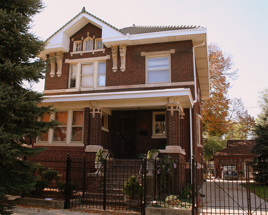
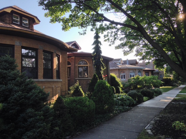
This walk takes you through two National Register Historic Districts: Rogers Park Manor and Talman West Ridge. The districts were so designated because of their collection of bungalows built between 1919 and 1930.

The bungalow was designed as a practical, efficient and affordable form of housing that allowed many to participate in the American Dream of home ownership. The bungalow is part of Chicago’s history and its legacy is the more than 80,000 bungalows or 1/3 of the city’s single family housing stock that still stands today.

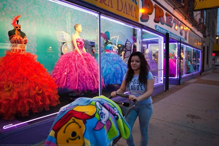
Between 1920 and 1929 over 22 nationalities (predominately European) were represented in West Ridge. Today, Jewish, Indian, South Asian, Hispanic and Black comprise a little over half of the ethnic makeup of West Ridge. The corridor of Devon Avenue known as “Little India” is one of the largest and most well-known Indian communities in the United States, with many Indian restaurants, shops and markets.

There is street parking on Lunt Ave., right in front of Indian Boundary Park.

1.) 2500 W. Lunt Ave., Indian Boundary Park

Indian Boundary is named after a territorial boundary established by the Treaty of 1816 between the Pottawatomie Indians and U.S. Government. The 1929 Tudor Revival fieldhouse features Native American themed ornament inspired by the park’s name. After a devastating fire in 2012, the building was restored and continues to exhibit Indian motifs throughout. In 2005, Indian Boundary Fieldhouse was designated a Historical Landmark by the City of Chicago and is also listed in the National Register of Historic Places.

Items 2 – 15 on this walk were taken from the Walking Tour, Rogers Park Manor, by the Historic Chicago Bungalow Association.

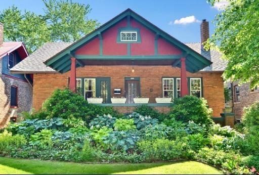
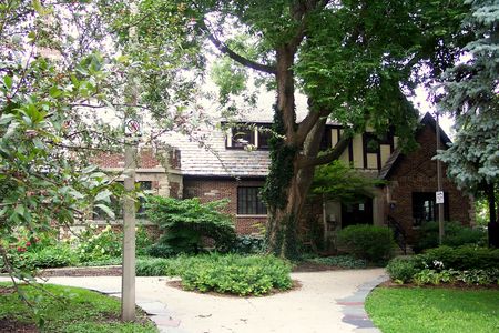
 2.) 2501 W. Lunt Ave., Jumbo Bungalow

This 1926 bungalow mansion, or “Jumbo Bungalow,” by the architectural firm Dewey & Pavlovich is an example of the transition from the economically designed bungalows of the early 1920s to the more extravagant bungalows of the late 1920s. As more white-collar families took interest in Rogers Park Manor, housing prices rose, and the form of the Chicago bungalow transformed. Bungalows built in the neighborhood after 1925 often featured rounded or polygonal front bays, inconspicuous corner or side entrances, and more costly details like art glass windows, carved limestone, and ceramic tile roofs. The metal and stained glass marquee above the entrance is an unusual detail that can only be found on a few bungalows in Rogers Park Manor. In the 1930s and 1940s, Harry Spanjer, who won gold and silver medals in boxing at the 1904 Summer Olympics in St. Louis, lived in this house with his three sons and housekeeper.

3.) 2553 W. Lunt Ave., Home of Joe Aiello

Known gangster Giuseppe ‘Joe’ Aiello, lived with his extended family in this two-story home until his murder in 1930. The Aiello clan was the principal rival of Al Capone for alcohol bootlegging in the north side of Chicago in 1927. Joe Aiello’s son, Tony, was among those sought in the murder of rival gangster ‘Big Tim’ Murphy, who also lived in the district at 2525 West Morse Avenue.

4.) 2620 W. Coyle, Last Bungalow Built in the District

The Stock Market Crash of 1929 brought an end to the 1920s building boom that had fostered the evolution of the Chicago bungalow. Just weeks before the crash, the last Chicago bungalow to be built in Rogers Park Manor was completed on September 24, 1929. Edward Reynolds’ bungalow, which he resided in, represents the climax of bungalow building in the district. The only true rounded bay in the district, uninterrupted by corners or piers, completed the trend from rectangular and one-dimensional to rounded and multi-dimensional.

5.) And 6.) 2450 and 2453 W. Coyle Ave., Experiments in Bungalow Design

John J. Gubbins and Allan McDonald of the development firm Gubbins & McDonald lived across from each other in these two Mediterranean inspired bungalows they built in 1925. Gubbins, the business owner, lived at 2450 W. Coyle with his wife and young daughter, and McDonald, the builder, lived at 2453 W. Coyle also with his wife and young daughter. The duo, whose office was near the northeast corner of the district at Lunt and Western Avenues, contributed some of the first innovative bungalow designs to Rogers Park Manor. Gubbins’ home, with its second floor sleeping porch and hidden side entryway, shows architect Lyman Allison’s willingness to experiment with the standard form of the Chicago bungalow. On the other hand, McDonald’s home, which was built together with its nearly identical neighbor at 2449 W. Coyle, was a radical departure from the accepted form of the Chicago bungalow.

7.)  2416, 2418, 2422 W. Morse Ave.,  Late Bruns Bungalows 

Benedict Bruns was the most prolific bungalow architect in the Rogers Park Manor district, contributing a total of 47 homes. His earlier square-front bungalows were practical with modest ornamentation. In 1925, Bruns designed 16 bungalows, 13 of which were some of the earliest in the district to feature polygonal front bays. Bruns’ bungalows were also among the first in the district with more developed ornamentation, featuring various brick patterns, limestone detailing, and leaded art glass windows. In 1928, Bruns designed these three elaborate bungalows, which represent the completion of not only Bruns’ progression in the district, but also the progression of the bungalow building trend in Rogers Park Manor: breaking the mold of the early practical bungalows, but quickly fashioning another more elaborate mold to replace it.

8.)  2441, 2443 and 2447 W. Morse Ave., Early Bruns Bungalows

These three bungalows designed by Benedict Bruns are typical examples of the early form of the Chicago bungalow in the Rogers Park Manor district. Chicago bungalows built in the district before 1925 exhibit the same features with few exceptions: flat or slightly projecting front bays, groups of standard double hung windows, recessed corner or side entrances, and minimal geometric limestone detailing. These early bungalows in the district followed a simple, economical formula. Like most Chicago bungalow architects, Bruns relied on horizontal emphasis to connect his bungalows to the surrounding landscape through the use of low-lying rooflines, expansive eaves, grouped windows, and brick and limestone detailing. These three bungalows, which cost $7,000 and $8,000, were pricier than the average cost for simple formulaic bungalows—between $5,000 and $6,500.

9.)  2501 W. Morse Ave., First Chicago Bungalow in the District

In the fall of 1922, Swedish-immigrant contractor Arvid Nelson built for his family the first Chicago bungalow in the district. Features such as the arched entryway, broad overhanging eaves, painted red cement tile roof, and complementary mottled green and red face brick give character to the simply shaped bungalow. But it was the simple form that set the standards for the first wave of bungalow building in Rogers Park Manor.

 10.)  2525 W. Morse Ave., Home of Big Tim Murphy

The first owner of this late Bruns bungalow was known gangster Timothy ‘Big Tim’ Murphy. On June 26, 1928, he was shot and killed in front of his bungalow by four gunmen. The funeral was a large-scale affair, with attendees filling the street in front of his house to watch as Big Tim’s casket was carried out.

11.) 2524 , 2530, 2534, 2538, 2540 & 2544 W. Morse Ave., Mediterranean and Spanish Revival Bungalows

The six bungalows in this row by Gubbins & McDonald and W. C. Wright were some of the first innovative bungalow designs to be built in the district. Even a couple years earlier, the form of the bungalow at 2534 W. Morse can be seen elsewhere in the district—at the northeast corners of Farwell and Washtenaw, and Coyle and Rockwell—with double gables and a side porch and entryway. The six bungalows are modest examples of the Mediterranean Revival and Spanish Revival styles that were mostly popular among builders of much larger homes in the district.

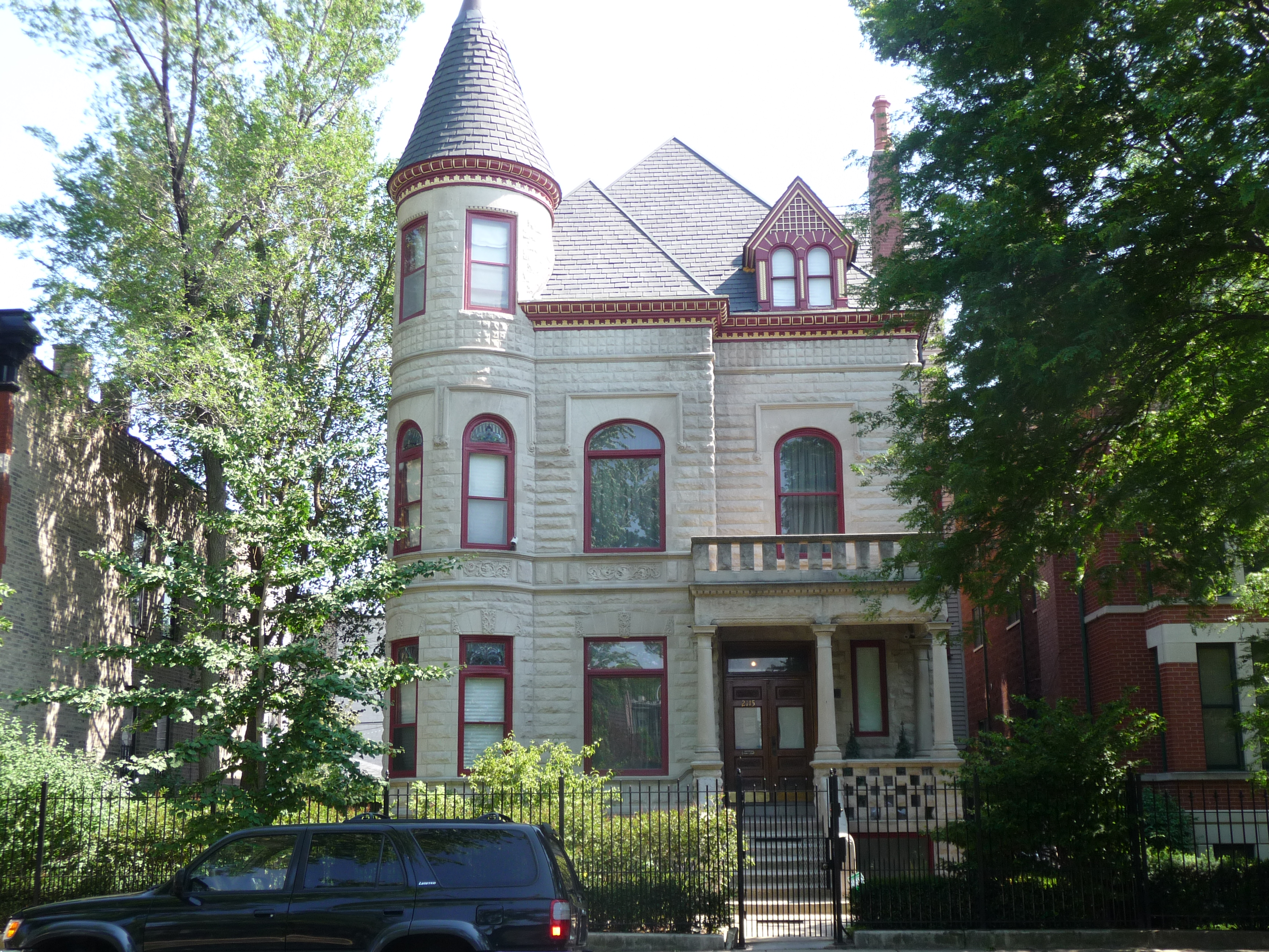
12.) 2557 W. Farwell, Home of Edward Zeches, Mediterranean Revival

Edward Zeches significantly contributed to the architectural landscape of Rogers Park Manor, and even chose to settle in the neighborhood. Instead of upscale bungalow living, however, he chose an even more extravagant Mediterranean Revival home (the most expensive home built in the district). During the bungalow boom of the 1920s, the secondary building trend of Romantic Revival styles guided the construction of larger single family homes in Rogers Park Manor. The primarily Tudor Revival and Mediterranean Revival homes were often built on more spacious corner lots, accenting but not interrupting the smaller scale bungalow housing on interior lots. Many of these larger homes were built by the same architects and developers who were building Chicago bungalows; and the case is true here with bungalow architects Dewey & Pavlovich. Zeches’ home is not only a notable example of terra cotta tile roofs, but the house is entirely clad in terra cotta.

13.) 2539 W. Farwell Ave., Square Front Bungalow

This 1925 bungalow is an example of early enlarged front rooms in the district’s bungalows. Early projecting bays like this one were contained under the main roofline of the house and projected only slightly from the bungalow’s primary rectangular massing. The shape of these early projecting bays was square as opposed to the polygonal and rounded front bays that later grew in popularity. Also typical of this bungalow subtype, the deeply recessed side entrance accommodates the enlarged bay which takes over the entire front of the house.

14.) 2434 and 2436 W. Farwell Ave., Arts and Crafts in Chicago Bungalows

The influence of the Arts & Crafts on the form of the Chicago bungalow can really be seen at these two early homes by Lyman Allison, who was responsible for 26 bungalows in the district. The covered corner porches are a more direct approach to the Arts & Crafts ideal of bringing the outdoors in. Allison’s corner porches would later be appropriated by other prolific architects in Rogers Park Manor, particularly Benedict Bruns. More common methods of connecting bungalows to the surrounding landscape can also be seen in this pair: low-lying rooflines, broad overhanging eaves, generous grouped windows, built-in planter brackets below the windows, and an overall horizontal emphasis. 2434 W. Farwell’s battered stone post is an Arts & Crafts influenced feature unique among Chicago bungalows.

15.) 2432 W. Farwell Ave., Early Chicago Bungalow

Arvid Nelson, the first Chicago bungalow developer in the district, built this quintessential square-front Chicago bungalow with a recessed corner entrance. It stands in marked contrast to its neighbors at 2434 and 2436 W. Farwell even though the three bungalows went up at the same time. Bungalows in Rogers Park Manor were built one at a time or in small groups of no more than five by dozens of architects and builders, as opposed to more rigidly planned bungalow neighborhoods in which homes were built in large groups. Therefore, the great diversity among the district’s bungalow stock is not only due to the late-1920s transformation the form of the Chicago bungalow underwent, but also to this building pattern. Despite the variety, the district maintains a sense of uniformity due to the prominence of 1 ½ story brick bungalows with common features such as low-pitched roofs, broad overhanging eaves, offset entrances, grouped windows, and limestone detailing.

Cross Pratt and walk down Talman Ave. to Devon Ave. This is the heart of the Talman West Ridge Bungalow Historic District.

16.)  Devon Avenue     Walk around and take in the sights in “Little India”. Here are some good places to check out:

      A.) 2616 W. Devon, Regal Trader: Indo-Pakistani fabrics, clothing and bedding

      B.) 2610 W. Devon, Patel Bros Grocery: Are we still in Chicago?

      C.) 2536 W. Devon, Tiffin: Popular restaurant

      D.) 2439 W. Devon, Hema’s Kitchen: Popular restaurant


17.) 6601 N Western Ave., Warren Park

This park was once a private country club and was saved as open space from developers by a vocal group of residents and the help of then governor, Richard Ogilvie in 1969. With almost 90 acres of land, this Chicago Park is the largest in the North Region.  Some of the stately old homes along Pratt Blvd. across from the Park were built by members when the property was still a private club so they could be close to the club and the golf course.

If you are a member of Map My Walk, here is the link to send map to your phone: West Ridge Walk 

Additional Resources: What is a Chicago Bungalow?  Current National Register Chicago Bungalow Historic Districts


Little Village

Length of Walk: 3.73 miles (about a two hour walk)

Where it is located: Little Village is a neighborhood in the South Lawndale Community Area. It is marked by number 3 on the Walk Location Map.

Little Village Arch

How we got there:   We drove and parked on Marshall Blvd. (see map below) or you can plan your trip on public transportation here: CTA Trip Planner


Murals and shrines Little Village
Murals and shrines in Little Village

Comments from Marge: This is one of the most unique walks you will take in Chicago. When most hear of the location “26th and California” thoughts instantly go to the large Cook County Criminal Courthouse and crime. South Lawndale’s violent and property crime is lower than where I live, in the Near North community area. In addition, Little Village is a featured neighborhood on the Chicago Tourism website “Choose Chicago” , the official destination marketing organization for Chicago. With that out of the way (and you can always check the latest crime stats at the Chicago Trib),  I hope you will make it a point to visit here.

Cermak house
Anton Cermak’s House

Little Village is truly authentic in its Mexican ethnicity. Hipsters, art galleries and trendy restaurants have not yet invaded the neighborhood. Storefronts display pinatas and quinceanera dresses, homes have shrines in their front yards and murals adorn many building facades. Remnants of the area’s history before Mexican immigrants started arriving in the 80’s can be seen in a Prairie style field house or the homes of former famous residents, Anton Cermak (former mayor of Chicago) and John Shedd (for whom Shedd Aquarium is named). One of the most interesting aspects of this neighborhood is the imposing Cook County Criminal Courthouse and Jail. On one visit, we took a wrong turn and ended up walking around the entire complex. It left an impression! That is another very unique opportunity this walk can provide if you want to take the time.


Little Village dressesComments from Ed: I call this walk one of our Deep Tracks.   Like an overlooked song on a hit record album, this area is misleading.  Only by walking these streets can you connect with the vitality of Chicago life today. When you walk 26th street you are more in Mexico than America.  It is a safe and stimulating area for the curious and open minded.  The justice complex at 26th and California is the scene of millions of criminal justice dramas.   Due its function, it, too, is very safe.   Stand across the street and see humanity struggle with crime, poverty, and disadvantage.  It is hard to remain unchanged.  There is also rich Chicago history on this walk.   For a Chicago native or die-hard urban explorer, this may be your favorite walk.   It’s one of ours.


Printable PDF of this walk: Chicago Neighborhood Walk Little Village

The Walk: 

Map 2 041816


Little Village Walk

Little Village is a neighborhood centered on 26th St. in the South Lawndale Community Area.  It is predominantly populated by Mexican Americans and new Mexican immigrants to Chicago. It was originally settled by Irish and Eastern European immigrants in the late 19th century, after the Great Chicago Fire sent the population of Chicago rippling out from the city’s center to the outlying countryside. Jobs created by industrial development in the early 20th century also attracted residents to the Little Village area, adding to the community’s strength and viability as its own independent borough. By the mid-20th century, Little Village saw a marked increase in Polish immigrants escaping the ravages of war-torn Europe, and in the ’80s a large influx of Mexicans moved to the neighborhood. Many of these new residents were transplants from neighboring Pilsen. They were displaced during the construction of the University of Illinois Chicago campus, which chewed up a large section of residential land, pushing inhabitants further west from downtown. But it is the injection of Latino culture that gives the Little Village neighborhood its vibrant and distinct character today. In fact, the neighborhood is called “Mexico of the Midwest” by many of its residents.

 1.) Drive by 2875 W. Cermak, Apollo’s 2000 on the way to park on Marshall Blvd.

This art deco building was originally the Marshall Square Theater, opened in 1917 as a vaudeville venue, later a silent movie theater, and currently a venue of banquets, weddings, and Latin music under the name Apollo’s 2000. Note the tragic placement of the strut for the Apollo’s sign right through the face of the beautiful terra cotta goddess above the main entrance.

Park your car on Marshall Blvd. near 23rd street or Maria Saucedo Scholastic Academy. Walk south on the sidewalk and you will see #2, Maria Saucedo on the East side of Marshall and #3, the Marquette & Joliet statue in the grassy area at the curve on the west side of Marshall Blvd.

2.) 2850 W. 24th Blvd, Maria Saucedo Scholastic Academy

Formerly the Carter Harrison High School, this massive school is now an elementary school, named for Maria Saucedo, an area teacher who died in a fire in 1981. Carter was the alma mater of clarinet player Benny Goodman and newspaper columnist Irv Kupcinet.

3.) Grassy area between Marshall and 24th Boulevards

Herman Atkins MacNeil completed this sculpture of Marquette and Joliet in 1926 under a commission from the Benjamin Franklin Ferguson Monument Fund. Benjamin, a Chicago lumber baron, left a million dollars in his will of 1905 for the purpose of erecting and maintaining enduring statuary and monuments along the boulevards or in other public places. Between 1905 and 1931 the Fund placed 10 sculptures throughout various parks and beltways of Chicago.

Round the bend on the sidewalk, and the first street you come to after the bend in Marshall, is S. Francisco Ave. It may not be marked with a street sign. Go south on the sidewalk along S. Francisco Ave to get to 26th Street.

4.) 2600 and 2700 S. California Ave. , Cook County Criminal Court House and Department of Corrections (Jail)

The Cook County Department of Corrections (CCDOC) is one of the largest (96 acres) single site county pre-detention facilities in the United States. Primarily holding pre-trial detainees, the Department admits approximately roughly 100,000 detainees annually and averages a daily population of 9,000. It was located here due to the clout of the neighborhood’s famous citizen, Anton Cermak: businessman, political boss and mayor of Chicago. A suggested addition to this tour would be to walk completely around this complex. The enormity of the place, the barbed wire, the guard towers and the tiny windows are foreboding and chilling. It will leave an impression.

5.) 3101 W. 26th, Little Village Discount Mall

This place is a real experience, with what seems to be hundreds of vendors crammed into nooks and crannies and aisles throughout the vast warehouse. Lucia Ahrensdorf of The South Side Weekly put it best: “Need to replace the rusty carburetor in your car and pick out a wedding dress at the same time? Look no further. Want to give yourself a tattoo? Tattoo kits are available for only $250. There is no better place to pick out an intense Halloween costume, or else browse for formal attire. Little Village Discount Mall showcases all the options for elegant toddlers, including tiny tails, tiny mariachi suits, and fluffy, white, First Communion dresses. So when you’re looking for an industrial-sized mixing bowl for the next time you want to make soup for a thousand people, BMW-brand cleats to kill it at your next fútbol match, or a tiny green parakeet to sing you to sleep, you know where to go.”

6.)  26th and Albany, Terracotta Arch over 26th St.

This arch welcomes you to Little Village. The clock in the arch was given by the Mexican government in a visit by Mexico’s president in 1991, but has only worked intermittently in the years since then. It has been repaired, only to break again. Whether to repair it or get rid of it is a subject of controversy.

7.) 26th Street

You might be surprised to know that this 2 mile stretch of 26th street is second only to Michigan Avenue as the highest grossing shopping district in the city. Family owned bakeries, restaurants, clothing stores, grocery stores, and barbershops give the Mexican American residents the food, clothing and household goods of a country they left behind.  On the weekends there is an influx of Hispanics from suburbia and the entire Midwest shopping for goods that remind them of home. Take a leisurely stroll and take in sights that you will see in few places outside of Mexico.

8.) 2500 S. Christiana Ave., La Catedral Café and Restaurant

The décor is religious artifacts and worth a look see. The restaurant is very popular. We were there on a Sunday around lunch and it was interesting to see all the young couples waiting for a table for brunch. It could have been Wicker Park or Logan Square!

9.) 2500 S. Christiana Ave., Las Quecas Quesadillas

This restaurant is connected to La Catedral, but its entrance is on 25th Street. The chef is the same for both restaurants. If La Catedral is packed, you can find a table here and enjoy a wide range of quesadillas.

10.) 2348 S. Millard Ave., home of Anton Cermak, Mayor of Chicago 1931 – 1933

Anton Cermak, businessman, party boss and mayor of Chicago from 1931 – 1933, lived here from 1923 until his death in 1933. The home was put on the National Register of Historic Places in 2011. He was Chicago’s only foreign born mayor, born in Austria-Hungary (now the Czech Republic) in 1873. On February 15, 1933, Cermak was in Miami with FDR on a presidential campaign trip and was shot by a bullet intended for FDR. The mayor lingered for 20 days before dying. The story goes that Cermak told FDR in the hospital, “I’m glad it was me instead of you”. 22nd Street was named Cermak Road after his death.

Cermak lived in this neighborhood from the time he was 19 and had strong ties to the then largely Bohemian neighborhood. When his body was returned to Chicago, it stayed in this home for visitation the day before his funeral. On a freezing winter night, hundreds of neighborhood people lined up in the cold to see him one last time. Cermak is buried in the Bohemian National Cemetery in Chicago.

One last interesting fact is that his son in law was Otto Kerner, Jr., the governor of Illinois from 1960 – 1968, who was subsequently jailed for a couple of years after a bribery scandal.

 11.) 2316 S. Millard, home of John Shedd

This Queen Anne home that John Shedd built and lived in from 1888-1906 is remarkably intact, retaining its original porch with simple turned columns. Shedd moved to a 22 room Gothic mansion in Kenwood after living here. Shedd (1850 – 1926) was the second president and chairman of the board of Marshall Field & Company. Under Shedd’s presidency, Marshall Field’s became the largest store in Chicago and the largest wholesale and dry goods company in the world. Although he donated $3 million to start the Shedd Aquarium in the early 1920s, he never saw it built, as it opened in 1930, 4 years after he died.

 12.) 3660 W. 23rd St., Shedd Park

Fieldhouses like the Shedd Park Fieldhouse were built to serve as the centers of recreational activities in the City’s smaller parks in working-class neighborhoods. The original 1917 portion of the fieldhouse was designed in the Prairie style by William Eugene Drummond, a protégée of Frank Lloyd Wright and one of the City’s most skilled designers in the Prairie tradition. The building’s rear gymnasium addition, also designed in the Prairie style in 1928, was the work of the architectural firm of Michaelsen and Rognstad who produced a variety of excellent historically inspired designs in Chicago, including large fieldhouses for Humboldt, Garfield and Douglas Parks. The fieldhouse was named for Chicago entrepreneur and philanthropist John G. Shedd, who donated the land for the surrounding park which also bears his name. This fieldhouse is a Chicago Historical Landmark.

On the way back to your car, meander up and down the residential streets off 23rd to get a feel for the way people live in the neighborhood. You will see some interesting landscaping as well as some religious shrines in their yards. There are murals sprinkled on buildings around the neighborhood.

13.) Drive to Manuel Perez Memorial Plaza at 26th and Kolin before leaving

If you’d like to see one last sight before leaving, drive west down 26th Street to The Manuel Perez Memorial Plaza, a small park featuring murals and mosaics honoring Manuel Perez Jr., who was posthumously awarded the Congressional Medal of Honor for his actions in the Battle of Luzo, Phillipine Islands in February, 1945, a month before he was killed in action.

If you are a member of Map My Walk, here is the link to send map to your phone: Little Village Walk

Additional Resources: About the New Paseo walking and biking path, South Lawndale, Crain’s piece on 26th Ave Shopping District, Wikipedia


Irving Park

Length of Walk: 3.48 miles (about a two hour walk)

Where it is located: Irving Park is one of the 77 community areas of Chicago. This walk will take you through 4 (Old Irving Park, West Walker, Independence Park and The Villa) of the 8 neighborhoods that make up the Irving Park Community Area. It is marked by #2 on this map: Location of Walks

How we got there:  We drove and found street parking right by the start of the walk. There is a Starbucks at the corner of Irving Park and Kostner if you want to grab a cup or use the facilities before starting out. The Blue Line stops in Irving Park and you can plan your trip on public transportation here: CTA Trip Planner

The villa

Comments from Marge: This walk has it all! Homes dating back to the 1800s, diverse architecture, murals, National and Chicago Historical Landmarks, the best barbecue in Chicago, and a sense of place carefully preserved by the community and its many neighborhood associations. My favorite stop on the walk is the Villa District, the absolute cutest and smallest neighborhood in Chicago. Tucked away in the most unlikely location, you will find craftsman and bungalow style homes from the early 1900s, boulevard streets with landscaped medians and distinctive stone planters marking the place.

Villa planter


Comments from Ed: Marge has said it all; almost.   With this walk you can observe, more than anywhere else in the City, the gash that the expressway made when it was built. Walk the underpasses and then hear the traffic as you walk these idyllic streets and you can feel the anguish that the residents felt, when they dealt with this assault.  The neighborhood gives new meaning to the term Not In My Backyard.


Printable PDF of the Walk: Irving Park Walk and Map

The Walk: 

Irving Park Map Screen Shot dotted lines_edited2

Irving Park Walk

Irving Park’s development began in 1869 when 4 New Yorkers purchased farmland in what is now the Old Irving Park neighborhood. They originally intended to farm, but after seeing the success of the suburban communities sprouting around them, decided to subdivide the land and create an exclusive settlement 7 miles from the city.

The original name chosen for the new community was “Irvington” after the author Washington Irving.  As the name was already taken by another town in Illinois, the name of Irving Park was adopted.

Mansions and grand homes built in a variety of architectural styles gave way to less pretentious homes after the influx of residents after the Chicago Fire. This walk will take you through neighborhoods with homes built in the Victorian, Foursquare, Revival, Craftsman and Bungalow style. It will take you by the oldest home left in Irving Park, built in 1856 as well as the beautifully restored Carl Schurz high school, known for its prairie architecture.

Irving Park suffered during the Depression and its post WWII prosperity was diminished by the announcement that the Northwest Expressway (now the Kennedy) would cut right through the heart of the community. Today, many young families and professionals call Irving Park home as they discover its rich architectural history and heritage. Preservation efforts are ongoing through home restorations and the efforts of the Irving Park Historical Society.

The Irving Park Community Area consists of 8 neighborhoods. You will walk through 4 of them on this tour: Old Irving Park (the historical core), West Walker, Independence Park and the Villa.

Map numbers correspond to:

1.) 3854 N. Kostner Ave.

Home of John and Clara Merchant.  It was approved as a Chicago Landmark in 2008 and much of the content below is from the Landmark Designation Report.

The John and Clara Merchant House, built ca. 1872 from a pattern in Woodward’s National Architect (1869), is a handsome Second Empire-style building near the corner of Kostner and Byron avenues. Its large mansard roof and carved flat-lintel window hoods exemplifies the style and visual character of the large single-family homes that dotted the Grayland settlement in the 1860s and 70s.

Clara was the daughter of John Gray, one of the original owners of the farms that were the basis for the Irving Park Neighborhood.

John and Clara Merchant and their seven children lived in the house until about 1879 before moving to Russell, Kansas. They put the house in a trust, but returned in 1886, presumably because Clara’s mother (Phoebe Gray) had died. Upon their return, the Merchants began holding religious services in the house, and in 1886 formed the First Baptist Church (later called Irving Park Baptist Church). John Merchant died in the house in 1913 and Clara Merchant, who had later moved from the house, died in 1927.

The Merchant House is an exceptional example of the Second Empire style. It is named after the reign of French emperor Napoleon III (1852-1870), commonly called the “Second Empire,” and is based on a nineteenth-century reinterpretation of seventeenth-century French Baroque architecture. In America, the Second Empire style was seen as a prestigious and stylish European architectural style, worthy of emulation by wealthy American clients with a hunger for European chic. Introduced in the U.S. in the 1850s, the style was especially popular for stylish single-family houses in the 1860s and 70s.

2.) 3945 North Tripp Avenue

House of Stephen A. Race, designated a Chicago Landmark in 1988

This home is significant in the history of Chicago and the neighborhood of Irving Park. It is the only remaining home of the original founders of Irving Park – the Race family. The Stephen A. Race house is a rare Chicago example of a red brick Italianate structure with its architectural integrity for the most part still intact. Originally sited on Irving Park Boulevard, a road that was once an Indian trail in early Illinois, the home’s style is especially representative of the type of grand residential dwellings that once lined Irving Park Boulevard in the mid- to late-nineteenth century, when Irving Park was a suburban/country retreat.

When originally built, the home cost $12,000 – a significant amount of money in 1873. The Charles T. Race House, which no longer exists, was slightly grander in scale and cost $15,000. Both homes were of the Italianate style, one of the most popular architectural styles between 1850 and 1880. While the architect’s name is unknown to us today, the similarities of the Race homes indicate the brothers used the same architect.

Four stories high, the Stephen A. Race House is composed of red brick contrasted with white limestone and painted wood trim; its style is derived from the villas of Tuscany in Northern Italy, which are characterized by a symmetrical box shape capped by a flat roof. Large eave brackets dominate the cornice line of Italianate houses. On the Race House, these are over-scaled, elaborately scrolled and arranged in pairs – typical of this era and style.

Particularly arresting is the treatment of the windows on the second level. Tall and thin, with two-over-two lights, they are emphatically framed with semi-circular arches stamped by a prominent limestone keystone.

3.) Positive Babel Mural at Metra Station Underpass by Tony Passero

At Irving Park Road at the Metra underpass bounded by the Kennedy Expressway exit and Keeler on the north wall and the Kennedy Expressway entrance  and Avondale on the south wall. Created for the Old Irving Park Association, the base concept of the Positive Babel mural is the world lives, works and plays in Old Irving Park. There are 70 landmarks and iconic structures from various nations throughout the world represented in the mural. The blue in the sky of the mural was selected to represent the color of the Chicago flag.

4.) 4053 N. Keeler Ave.

On the SE corner of N. Keeler Ave. and W. Belle Plaine now stands the Fullness Presbyterian Church.  Originally the Dutch Reformed Church, it was constructed in 1872 and was the only house of worship for 13 years. The building was completely remodeled in 1908 in a combination of Gothic Revival and Arts and Crafts design by noted architect Elmer C. Jensen. Elmer C. Jensen worked as an architect in Chicago for 70 years, earning him the title of “The Dean of Chicago Architects.” Jensen designed his own residence at 4041 N. Lowell in the Colonial Revival style, the most notable feature being the massive portico featuring four 18 foot high concrete over brick columns.  (The home is noted on the map but not a numbered stop on this tour.)

5.) West Walker Neighborhood

You will pass through the corner of this neighborhood, characterized by large single family homes in late Victorian, Foursquare and Revival styles.

6.) The Independence Park Neighborhood and Park

The Independence Park Neighborhood was established in the 1800s, and it retains the vintage character of oversize lots, mature trees and generously sized homes in a variety of period styles. Independence Park itself was established in 1914. The attractive brick fieldhouse was designed by Hatzfeld and Knox. Independence Park was once considered the best landscaped park in the city, but it is now mostly a bland assortment of ball fields and playgrounds. The park was named to the National Register of Historic Places in 2009.

7.) Gross Boulevard addition

The area south of Irving Park Road was developed by Samuel Gross and was known as “Gross Boulevard addition to Irving Park”. The housing stock is similar to that of West Walker.

8.) Mural under the RR overpass at Pulaski

This mural depicts the advertising that the original Irving Park Developers used to entice people to move there.

9.) The Villa

This is the highlight of the tour for me! This cute little neighborhood was dubbed the “Polish Kenilworth” by Mike Royko, a famous Chicago newspaper columnist. It is a Chicago Historical Landmark District. Developed in the early 1900s, its hallmark characteristics are the craftsman and bungalow style houses on boulevard style streets with landscaped medians. Stone planters mark the area.

Read more about this district in the resource links.  Or click here : “Getting to know Chicago’s Smallest Neighborhood: The Villa”

10.) Smoque Barbecue     3800 N. Pulaski

Smoque is at the corner of Grace and Pulaski. It is a very famous barbecue place with many awards and write ups. If you are really determined to eat here, you will have to be very patient. The line sometimes wraps around the building.

11.) Schurz High School 3601 N. Milwaukee Ave.

The school is named after German–American Carl Schurz, a statesman, soldier, and advocate of democracy in Germany. The school building, which represents a combination of the Chicago and Prairie schools of architecture, was designed in 1910 by Dwight H. Perkins and designated a Chicago Landmark on December 7, 1979. It is considered one of “150 great places in Illinois” by the American Institute of Architects. The AIA has described the school as Perkins’s masterpiece, “an important example of early-twentieth century architecture, utilizing elements of both the Chicago and Prairie schools.

12.) 4362 W. Grace John Gray’s First House

Gray’s first home built in 1856 at 4362 W. Grace survives today in a remarkable state of preservation and is the oldest house in Irving Park. John Gray was the owner of the farm which was bought by the 4 New York men to develop what is now known as Irving Park.

If you are a Map My Walk member here is a link to the route: Irving Park Route

More Resources to learn more about Irving Park: WikipediaThe Villa DistrictThe Villa Community AssociationPositive Babel MuralMerchant House Landmark Designation ReportSmoque Barbecue


Wicker Park

Length of Walk: 1.43 miles (about a one hour walk)

Where it is located: Wicker Park is one of the neighborhoods that make up the West Town Community Area of Chicago. It is marked by a number one on this map: Location of Wicker Park Walk

How we got there:  I’ve done this walk several times and always found street parking. It is best to park somewhere near the actual Wicker Park, as that is where the walk starts. If you can’t find street parking, you can go to Spot Hero or a parking app to find a space. The area is well served by the “L” and bus if you prefer to take public transportation. To get there on the “L”, take the Blue Line and get off at the Damen stop.

Wicker ParkComments from Marge: This is a great walk for seeing historical homes and learning the history of the area. I like to bring out of town guests on this walk because it is so interesting and, at 1.43 miles, is short and sweet. Afterwards, we can stop in at any of Wicker Park’s wonderful restaurants for lunch or dinner.


Comments from Ed: Stately mansions with lush lawns side by side with urban grit. Hipsters and young families have invaded this quiet historic neighborhood. It is the pretense, but not the setting, for the 2004 thriller Wicker Park. This delightful little walk is perfect for tourists, out-of-town guests, or even a “date” walk. Full of pleasant surprises.


Printable PDF of the Walk: Wicker Park Walk and Map

The Walk:

Wicker Park Walk Map

Wicker Park Walk

Adapted from Frommer’s website:

Wicker Park, along with adjacent Bucktown, is mostly known today as a place to shop at edgy clothing boutiques or try out the latest hip restaurant. This tour takes you along the residential side streets that many tourists overlook but that testify to the rich history of this neighborhood. Middle-class artisans, mostly Germans and Scandinavians, began settling here around 1870. In the following decades, wealthy families whose foreign roots made them unwelcome along the Gold Coast built luxurious homes here as well. In the 20th century, the neighborhood’s respectability gradually declined, and many of the grandest homes were converted into rooming houses. It was not until the 1980s that the distinctive homes here began to be rediscovered and renovated, just as the gritty main streets of Milwaukee and Damen avenues began sprouting new shops and cafes.

Walk south along Damen Avenue to:

  1. Wicker Park

Two brothers who were beginning to develop their extensive real estate holdings in the area donated this land to the city in 1870, hoping the green space would make the surrounding area more attractive to prospective builders. Unfortunately, little remains of the 19th-century landscaping, which once included a pond spanned by a rustic bridge.

Cross the park to the corner of Damen Avenue and Schiller Street. Follow Schiller east, along the park, stopping first at:

  1. 1959-1961 W. Schiller St.

Built in 1886 for a ship’s captain and a medical doctor, this double home reflects the fashionable Second Empire style. The building became a rooming house in the 1920s but has been restored to its original style. Note the lively Victorian colors of the cornices, tower, and trim. Other distinctive features are the large mansard roof and the decorative saw-toothed pattern in the brickwork.

Next move to:

  1. 1941 W. Schiller St.

Built for clothing manufacturer Harris Cohn in 1888, this home is also known as the Wicker Park Castle. Essentially Queen Anne in design, its limestone facade made it pricier and more luxurious than its neighbors. Granite columns were polished to look like marble, and a turret rests on a shell-shaped base.

At the end of the block, turn right on Evergreen Avenue until you come to:

  1. 1958 W. Evergreen Ave.

Novelist Nelson Algren lived in a third-floor apartment here from 1959 to 1975. After he was caught stealing a typewriter in 1933, Algren (1909-81) spent 3 months in jail. This experience, which brought him in contact with criminals, outsiders, drug addicts, and prostitutes, was a strong influence on his work. Algren is best remembered for his two dark novels of the urban semiunderworld, A Walk on the Wild Side and The Man with the Golden Arm (which was set near here, around Division St. and Milwaukee Ave.), and for his tough but lyrical prose poem Chicago: City on the Make.

Continue to Damen Avenue, then turn right (north) back to Schiller Street. Take Schiller west 1 block to Hoyne Avenue, then turn right (north), where you’ll see:

  1. 1407 N. Hoyne Ave.

Built by German wine and beer merchant John H. Rapp in 1880, this was the largest single-family estate in Wicker Park at the time. The original coach house, behind the mansion, is now a separate residence. This was not a happy home. Mrs. Rapp went insane, a son was convicted of embezzlement, and Rapp was murdered by his female bookkeeper. The home itself is of Second Empire style, with a large, curved mansard roof. The original wrought-iron fence defines the boundaries of the original grounds.

Heading north, you’ll pass other late 19th-century mansions and, at 1426 N. Hoyne Ave., an example of a worker’s cottage, a reminder that in these immigrant neighborhoods, artisans and their patrons often lived side by side. On the next corner, at Hoyne Avenue and Le Moyne Street, is the:

  1. Wicker Park Lutheran Church

The city’s oldest Lutheran church, it was modeled from plans of Holy Trinity Church in Caen, France, dating from the 12th century. The stone for this Romanesque structure was recycled from a demolished brothel. When one of the scandalized parishioners protested, the pastor remarked that the building material “has served the devil long enough; now let it serve the Lord.”

Walk on to:

  1. 1558 N. Hoyne St.

The building permit for this Queen Anne-style home was issued in 1877, making it one of the oldest homes in the area. It was built for C. Hermann Plautz, founder of the Chicago Drug and Chemical Company. Ever conscious of the Great Chicago Fire, the builders created all the decorative trim on both towers, the cornices, and the conservatory of the south side from ornamental pressed metal. The seemingly misplaced cannon in the front yard is a relic of the years (1927-72) when the building housed the local American Legion.

Return to Pierce Avenue and walk west to:

  1. 2137 W. Pierce Ave.

This well-preserved gem is one of the highlights of historic Wicker Park. Built for the German businessman Hermann Weinhardt in 1888, it’s a fanciful combination of elements that defies categorization. Notable details include the elaborate carved-wood balcony and the unusual juxtaposition of green stone and redbrick limestone around the large front window. The large lot used to be flooded in the winter for ice-skating.

Across the street is another notable home:

  1. 2138 W. Pierce Ave.

The original owner of this home, Hans D. Runge, was treasurer of a wood milling company, so it’s no surprise that elaborate wood carvings characterize the home inside and out; among the unique designs are the Masonic symbols flanking the pair of dragon heads under the rounded arch. A well-heeled local banker and politician, John F. Smulski, acquired the house in 1902, about the time many Poles were moving into the neighborhood. Smulski committed suicide here after the stock market crash in 1929, and the house served for a time as the Polish consulate.

Continue west until you reach Leavitt Street. Turn right (north) and walk to North Ave. Turn East (right). As you pass Hoyne Street, take a quick look at 1617-1619 N. Hoyne Ave.; the building used to house the neighborhood livery stables, where local families kept their horses and carriages. (It’s now condos.) The final stop on the tour is at 2039 W. North Ave., an address that used to house the:

  1. Luxor Baths

These public baths were built in the 1920s and were reportedly once a hangout for local politicians and wheeler-dealers. Today the building has been transformed into — what else? — condos. Still, it’s a fitting end to the tour, a reminder of the days when this was a neighborhood of European immigrants trading news from home in the Luxor Baths steam room.

Head east to the three-way intersection of Milwaukee, Damen, and North avenues. From here, you can hop on the Blue Line El train, or grab a bite to eat or return to your car.

If you are a member of Map My Walk, here is a link to send route to your phone: Wicker Park Walk

Click here for the history of Wicker Park on Wikipedia: History of Wicker Park